The Kingdom of the Atlantes People
The Kingdom of the Atlantes People
The Atlantes People of North West Africa
Atlantis was never lost. It was "Lost In Translation". Atlantis was always in plain sight put it took the instincts of a few people to show the world the obvious.
The West African Underworld Documentary Series
Our West African Underworld Documentary Series will include hefty doses of West African Atlantis history along with the ancient histories of peoples that came out of Africa and how that ancient West African History is a basis of many cultures around the world!
You can visit our website WestAfricanUnderworld.com dedicated to showing the accurate ancient history of West Africa to the World via documentary films and TV series and online via our Digital Studio content.
Atlantis was a North West African Kingdom
The Atlantes Peoples occupied the region of North West Africa including the Atlas Mountains East to Libya and isolated from the rest of the continent to it's south by the ancient Tamanrasset River.

Credit | Indie Rights | Indie Rights
The Kingdoms of the Ancient not so mythical Underworld shown here as ATLANTIS in the documentary film 'The Atlantis Puzzle'.
The Tamanrasset River is long and wide and essentially cuts North West Region of Africa off from the wider Sahel Region of West Africa.
The Tamanrasset created a river formed Peninsula or Island.

Credit | Indie Rights | Indie Rights
The outlines and the main course of the Tamanrasett paleowatershed are drawn in blue and grey,
As West African lakes and rivers dried up due to natural climate change between 3500 BCE and 1000 BCE the Atlantes Peoples eventually move across this formidable barrier and take Mauritania and Western Libya.

Credit | Indie Rights | Indie Rights
Complete identified Tamanrasett paleodrainage (blue), Tamanrasett River water valley as suggested by the Simulated Topological Network18 (dark grey band), Cap Timiris Canyon pathway15 (dark blue) mapped on the GEBCO bathymetry.
It is then that the Atlantes People occupied the famous Capital City Islands of the Eye of Sahara once called the Eye of Ghorus (ghorus means squint).
The description of Atlantis by Plato is a rather accurate description of the Mauritania down to the order of magnitude of the very 'stadia' with which he described the City Islands of Atlantis.
Herodotus placed the Atlantes people to the North East of the Atarantes People Atar Mauritania and the Adrar Mountains.

Credit | Herodotus |
Herodotus Map showing the location of the Atlantes People and the Atarantes People. in North West Africa.
Credit | Indie Rights | Indie Rights
Herodotus Map showing the location of the Atlantes People and the Atarantes Peope..
The Capital City Islands of the Atlantes Peoples
This was known as Lower AEgypt prior to the Atlantes Peoples

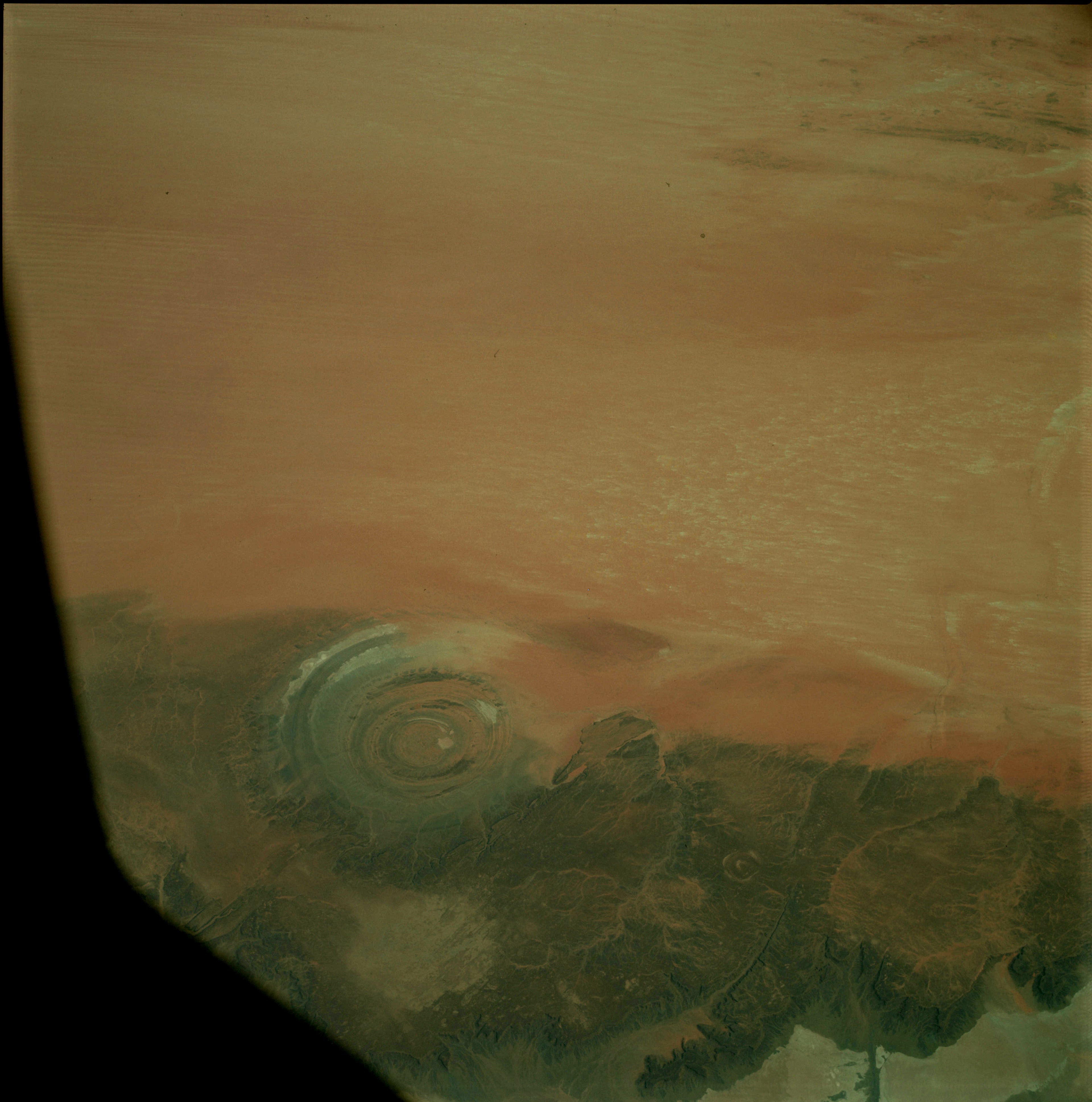
Credit | NASA | NASA/Gemini 4
The Eye of Ghorus and The Iris called "Os Iris".

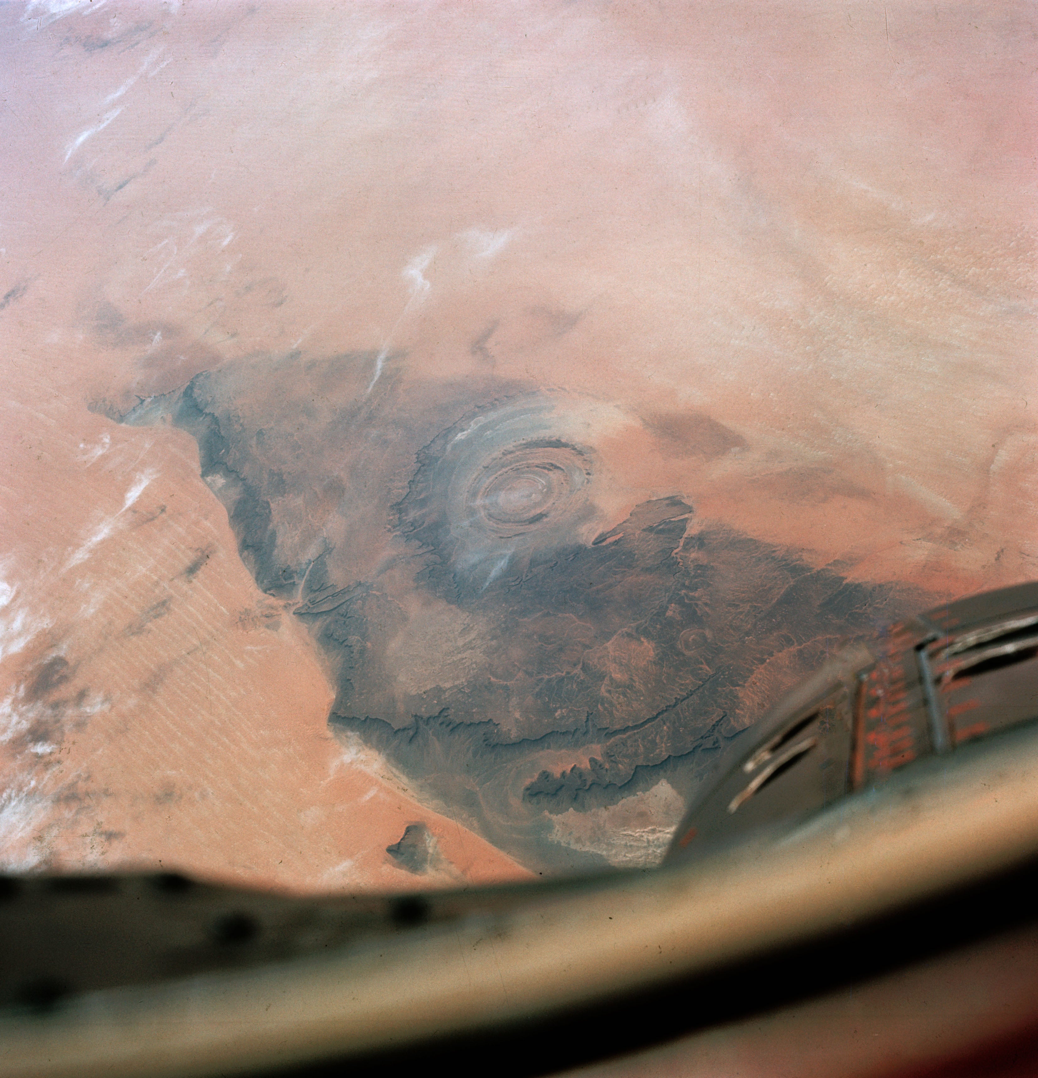
Credit | NASA | NASA
The Eye of Ouadane as seen from Apollo 9.

Credit | J.Boze | Pinnacle Hill | Pinnacle Hill
The 900 square mile lake forming the Iris of Eye of Ghorus.

Credit | J.Boze | Pinnacle Hill | Pinnacle Hill
The Island of Atlantis in the once 900 square mile lake that the Iris of Eye of Ghorus.

Credit | J.Boze | Pinnacle Hill | Pinnacle Hill
The Iris OsIris of Eye of Ghorus.